
- Date: 06/22/2013 (Saturday)
- Time: 1:15pm to 4:30Pm
- Meeting Place: Public Parking Lot at May Road, Union City
六月健行在6/22 舉行。今次健行將是登山活動。
Overview
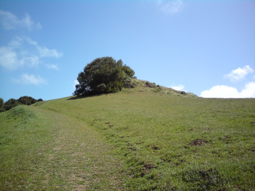
Tolman Peak (997 ft. elevation) is located at the southeast side of Garin / Dry Creek Pioneer Park, which is part of East Bay Regional Park System.
We will meet at the public parking lot at May Road, Union City at 1:15pm. The parking is free. We start here at1:30pm to the peak and back. Our route is 4.75 miles round-trip, and we should be finished within 3 hours. The Difficulty rating of this trail is “Easy” for usual hikers.
It starts with easy uphill hike, several creek crossings until a moderate uphill climb to Tolman Peak. After the peak, we will take the South Folk Trail, a well-shaded trail in the oak woods, to complete the loop around the hill and then takes the same way back to the trailhead. This is a great hike for people looking for solitude and great scenic views on the east bay. The best season to hike is early summer.
You can get more details of this trail from the link below.
http://www.everytrail.com/
(Please note that the introduction from the link above starts from Tamarack Ave, and we start from May Road. Don’t use the information from the link and wrongly go to Tamarack entrance.)
You also can get a park map from this link.
http://www.ebparks.org/Assets/
(Our route is at the lower right corner of the map.)
Directions
Directions to the May Road Parking:
The May Road is very short. You can even see the parking lot before you turn in May Road from Mission Blvd. You won’t miss it.
From Peninsula or South Bay,
- Using Hwy 237, Hwy 95 or Hwy 84 to reach I880.
- Following I880 instructions below.
People Using I880:
- Take Decoto Exit, eastbound to Mission Blvd, Hwy 238. (With Hwy 84, after crossing the bay, it will be Decoto automatically.)
- Turn left at Mission Blvd.
- The first traffic light after the turn will be May Road, turn right heading to the Parking Lot.
People Using I680:
- Southbound, take Mission Blvd Hwy 238 exit.
- Northbound, take the 2nd Mission Blvd exit of Hwy 238.
- Using Mission Blvd head north to Union City.
- After the Decoto, it will be May Road.
- Turn right at May Road to reach the parking lot.
The sign of May Road is small, and easy to be missed. There is a Shell gas station just opposite to the May Road. Look for this station.
Please be reminded that do not park in parking spaces of the neighborhood apartments. Towing cars always hunt at this area. If the parking is full, you can park at the road side at Mission Blvd.
What to bring
- Plenty of water.
- Hat, sun screen for a sunny day. (2/3 of the route is unshaded.)
- A spare jacket for the wind at the peak.
- Hiking boot and hiking pole are recommended.
Attachment
Please see the PDF file for more information. Hiking-2013-06-Tolman.pdf