April Hiking, 4/17/16(Sunday)

Alameda Creek Trail to Quarry Lake Park

Start time: 1:30pm

Gathering time : 1:15pm (4/17/2016)

Meeting Place : Niles Staging Area parking lot at Old Canyon Road, Fremont.

IMG_20160402_170344

This is a Sunday event on 4/17/2016.  It is a leisure walk about 6 miles with no slope climbing.  We start at 1:30pm and should finish it before 5:00pm.

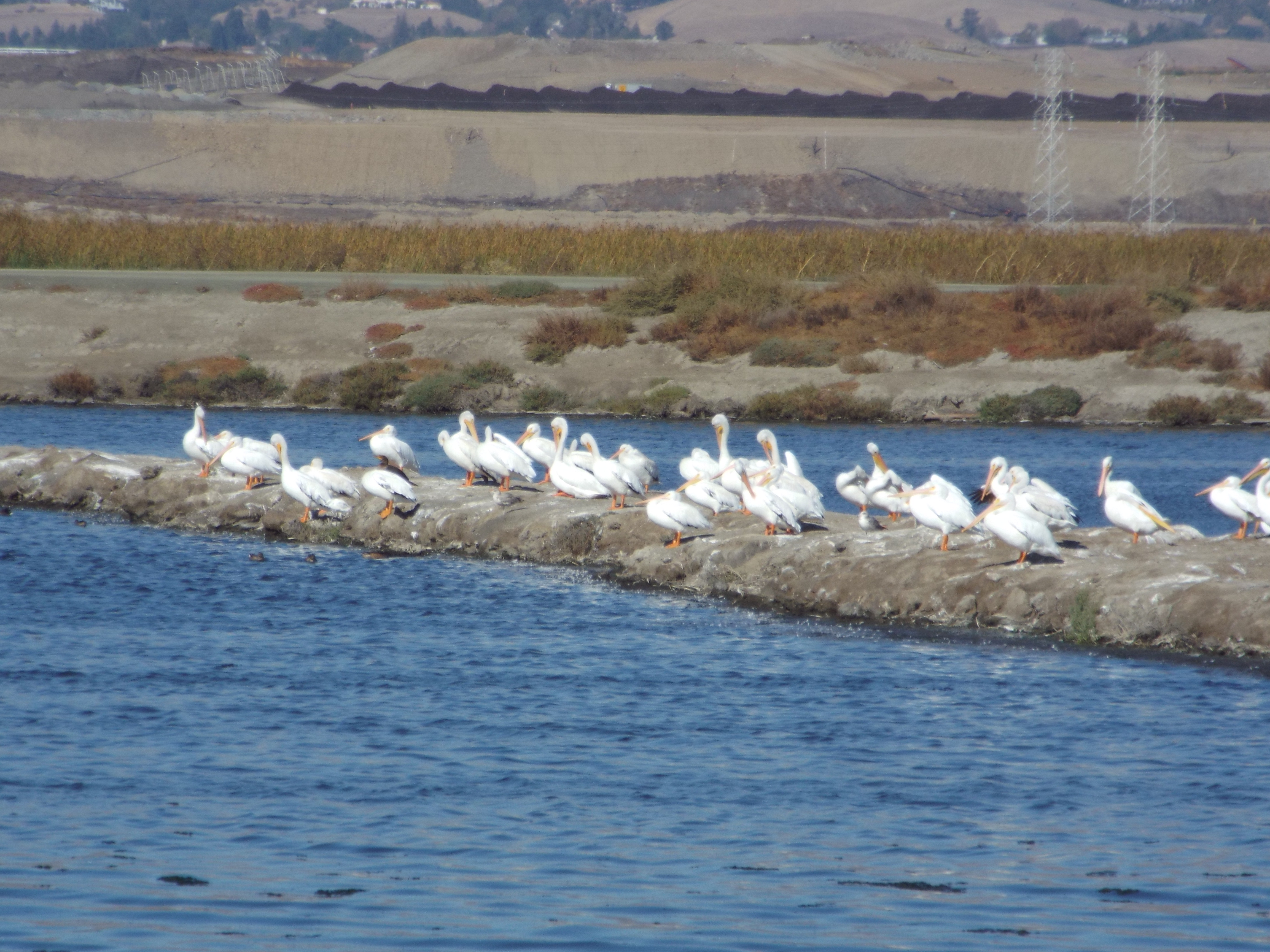
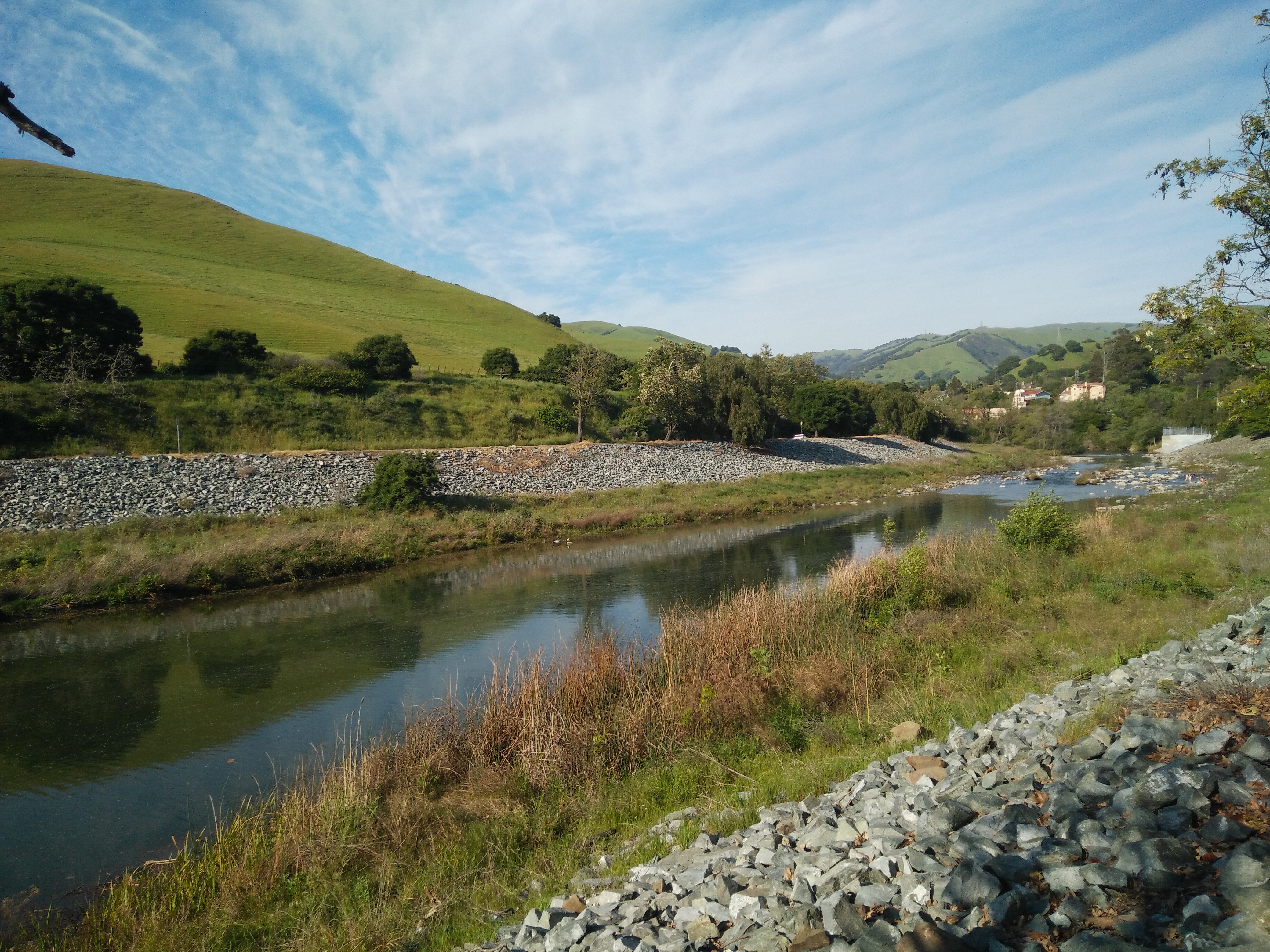
We will start from the trail head at Niles Staging Area. We walk along the south band of the trail to reach the Sequoia Bridge, then enter to the Quarry Lake Park.   We walk along the lake side and exist from the East entrance of the Park, then take the north bank of the trail back to the Niles Staging Area

What to bring:

  1. The signed waiver form. (you can download one from http://www.ncuaanc.org/nccuaa-nc-waiver-form)
  2. Plenty of water, snacks.
  3. Hat, sun glass, sun screen, a light jacket.
  4. Leisure dress should be fine; hiking boots are recommended, but hiking pole is not necessary.

Directions :

  1. If you are from I680 south bound, take the CA84(Nines Canyon Road) towards Fremont. Before the Mission Blvd, turn left to the Old Canyon Road. After the bridge across the creek, the parking lot is at your left hand side.
  2. From I680 north bound, take the CA 238 (Mission Blvd) exit. Turn left to Mission Blvd. west. Turn right at the Niles Canyon Road.  Less than half mile, you need to turn right to Old Canon Road.  After crossing the bridge over the creek, the parking lot is at your left hand side.
  3. Hayward and Fremont local, take the 238(Mission Blvd), turn to Niles Canyon Road. Less than half mile, turn right to Old Canon Road.  After crossing the bridge, the parking lot is at your left hand side.
  4. From I880 south bound, from Oakland, take the exit of Mowry Blvd. Drive all the way down to Mission Blvd., turn left at Mission Blvd, then right to the Niles Canyon Road.  Less than half mile, you need to turn right to Old Canon Road.  After crossing the bridge, the parking lot is at your left hand side.
  5. From I880 north bound, from Milpitas/San Jose, take the exit of Stevenson Blvd. Drive all the way down to Mission Blvd., turn left to Mission Blvd. Turn right at the Niles Canyon Road. Less than half mile, you need to turn right to Old Canon Road.  After crossing the bridge, the parking lot is at your left hand side.

Hiking on 3/12 (Sat), 2016

Hiking on 3/12 (Sat), 2016

Coyote Hills Regional Park, Fremont, CA

http://www.ebparks.org/parks/coyote_hills

Start time: 1:30pm

Meeting Place : the Quarry Staging Area, the first parking lot inside the Park

To Reach the Park

Coyote Hills Regional Park is located at 8000 Patterson Ranch Road, Fremont, CA 94555. The park’s main entrance is at the west end of Patterson Ranch Road/Commerce Drive in Fremont. From I-880, take Highway 84 west, exit at Paseo Padre Parkway, turn right, and drive north about one mile. Turn left on Patterson Ranch Road. This is the park’s entrance road. The entrance fee is $5.

After driving through the entrance, drive about another half mile, and you will see the Quarry Staging Area in your left hand side.  It is the first parking lot after the entrance.  We will meet here, and start from here.

There is a free parking lot at the left hand side before the entrance.  You may park your car here and walk through the entrance, and walk along the Patterson Ranch Road about 15 minutes to our meeting place.  (You can also do your car pooling at here.)

We will start from the Bayview Trail.  We then take the Red Hill Trail uphill, then downhill to the Visitor Center, and return to the Parking lot. For people do not like to take any slope hiking, they can continue the Bayview Trail back to the parking lot.  The whole route is about 4 miles.  We should finish our event around 4:00pm.


What to bring:

  • A signed Waiver Form, you can download a copy here :

http://www.ncuaanc.org/nccuaa-nc-waiver-form/

  • A jacket, and a rain coat.
  • Plenty of water, snack.
  • Sport shoes or hiking boots.

Nov. 14, 2015 Hiking: Migratory Bird Watching

11/14 Migratory Bird Watching
Start Time: 1:30pm
 Gathering: SFO Bay Wildlife Refuge Environment Education Center  ( 1751 Grand Blvd, Alviso)
 
This is our last hiking event in 2015.  It is a 3.5-mile leisure walk to watch the migratory birds.  Bring your camera and telescope to watch these birds.  Hundreds to thousands of them are there.
 DSCF1353
We will start from the Education Center at 1:30pm.  We will walk north to the outfall of Coyote Creek and back to the Educational center.
SFO Bay Wildlife Refuge Environment Education Center 
Address: 1751 Grand Blvd., Alviso, CA 95002
Parking is free.  (Do not wrongly go to the Visitor Center at Fremont. )
Direction:
·        Take CA 237
·        Exit N. First Street, head north to the Bay direction.
·        Turn right at Nortech Pkwy.
·        Turn left onto Disk Drive
·        Continue straight to become Grand Blvd.
What to bring:
        The signed Waiver Form.
        Hat, sunscreen, sun glass. (100% no shed)
        A jacket. (can be windy at the seashore)
        Plenty of water, snack.
        Hiking pole is not necessary.

Hiking on 9/19/2015 (Sat)

2015-09-19 Hiking

Alviso Marina County Park to SFO Wildlife Refuge

Start at 1:30pm

Meeting Place: Parking Lot of Alviso Marina County Park

Due to the concern of the high risk of mountain fire, we will repeat our route in last September. It is a leisure walk without any climbing at the seashore.  Our route starts from the Alviso Marina County Park and walk to the San Francisco Wildlife Refuge at Santa Clara.  Two options are available.  You can join our walk from the parking lot to the ghost down of Drawbridge, then return to the parking lot for a 4-mile walk.  Or, you can continue to walk around the salt pond to watch the migratory birds for a complete 7-mile walk.

You can get more information about our route from the link below.

https://www.sccgov.org/sites/parks/parkfinder/Pages/AlvisoMarina.aspx

What to bring:

  • A signed wavier form
  • (you can download from here, http://www.ncuaanc.org/?attachment_id=2103 )
  • Plenty of water
  • Sun glasses, hat. (100% no shed)
  • Use sunscreen.
  • A spare light jacket. Exposed areas of the bay can be very windy.
  • No dog. Pet is not allowed in this refuge.

Direction:

  1. Address of Alviso Marina County Park is 1195 Hope St, Alviso, CA 95002
  2. Take Hwy237, exit Great America Parkway
  3. Turn to the seashore direction for Gold Street Connector
  4. Turn left to Gold Street
  5. Gold Street to the end will be Elizabeth St.
  6. End of Elizabeth St. will be Hope St.
  7. Turn right to Hope St. and enter to the Park.
  8. Parking is free.

July Hiking(7/18): Mt. Rose Summit Trail @ Reno, NV

July Hiking(7/18): Mt. Rose Summit Trail to Relay Peak

This is one of the trails of the Tahoe Rim Trails (TRT).   You can watch the pretty mountain view at your right hand side while the beautiful Lake Taohoe scenery at your left hand side.  You can have more details of the beauty of it from the introduction through this link.
http://www.summitpost.org/relay-peak/300034

We will meet at the parking lot of the trail head in the morning of 7/18 at 7:30am.  This parking lot is also named the Mt. Rose Summit Welcome Plaza.  However, if you search this name in Google Map, it will wrongly point you to the Mt. Rose Ski Resort.  You must use ”Mt. Rose Summit Tahoe Rim Trail Trailhead” for the Google Map Search.
 We will start at Mt. Rose Welcome Plaza.
 At 2.5 miles turn left at junction of Old Mt. Rose Trail
 At 3.25 miles turn right at Junction of Relay Ridge Service Road.
 5.3 miles, reach summit of Relay Peak.
 It is about 5.5 miles one way.

You have to stay at Reno the night before this event in order to meet our gathering time in the early morning. You should book your hotel with easy access to the I-580. (For a quick reference, it will need 35 minutes from Reno Airport to our gathering place in the morning without traffic.)

Direction to the trail head.
From Reno, Nevada, take I-580 South, and turn towards Mount Rose Highway (431) heading west. It takes roughly 20 minutes, 15 miles up the winding mountain road to reach the trailhead.  It will appear at your right hand side. (Refer to the map and picture below.)

(People ask about the option of staying at Kings Beach at Lake Tahoe. It is a possible option. You also take 431 to reach the Welcome Plaza. It will appear at your left hand side.)

The parking lot at this trail head has only 50 parking spaces. You are strongly recommended to do carpooling with someone.  Trailhead’s GPS position for your reference: 39°18’48.2″N, 119°53’50.6″W . (39.313377, -119.897390)

We estimate our event ends around 4:00pm. Although you can drive back to Bay Area after that, we suggest you to stay at Reno one more night with good rest. We can reward ourselves with a buffet dinner together on that night.  It will be fun.

What to bring:
1. The signed Waiver Form. You can download it from :
http://www.ncuaanc.org/?attachment_id=2103
2. A pack of light lunch, plenty of water, snacks.
3. Hat, sunglass, sunscreen lotion.
4. A light jacket.
5. Hiking boots and hiking pole are recommended.

If you have any question on this event, please feel free to contact Paul Lee, paullee_usa@yahoo.com.  And you can also email me for the registration of joining this event.

Regards,

Hiking, Angel Island, 5/30/2015(Sat)

Hiking on 5/30/15, Angel Island

 Angel Island-2 The Angel Island is the largest natural island in the San Francisco Bay, which offers a 360°view to the SFO Bay.  We will walk along the paved Perimeter Road circle the Island, and visit the Immigration Station concentration camp at the north.  The whole trip is about 6 miles.

You can download a brochure and a map from this link:

http://www.parks.ca.gov/pages/468/files/AngelIslandSPlWebLayout2014.pdf

There are two ways to get to Angel Island State Park by ferry: On the Angel Island Tiburon Ferry out of Tiburon or on a Blue & Gold Fleet boat out of San Francisco.  The Tiburon’s schedule is not good to us.  We will take the Blue & Gold Fleet’s first scheduled ferry to the Island.  The Blue & Gold Fleet’s Angel Island service operates from San Francisco’s Pier 41 and the San Francisco Ferry Building’s Gate B.

Beginning on May 2, 2015, there is connecting ferry operating by San Francisco Ferry from Oakland/Alameda to Blue & Gold Fleet at Francisco to Angel Island.  It is the most convenient way for people traveling to Angel Island at East & South Bay.

So, you can either take ferry at San Francisco, or Oakland to Angel Island on 5/30/2015.   The departure time from Oakland Jack London is 9:00am.  The departure time at SFO Ferry Bldg is 9:20am, and 9:40am at Pier 41.  (Please refer to the departure schedule details from the provided links below. )  The scheduled arrival time to the Island is at 10:10am.  We will meet there, and start our trip at 10:30am.  We will leave there by taking the 3:20pm ferry.  The arrival time to San Francisco is 3:45.  Due to the ferry connecting route, the arrival time to Oakland will be 5:20pm.

What you need to bring:

  1. A signed Waiver Form. (You can download at : http://www.ncuaanc.org/?attachment_id=2103 )
  2. A pack of light lunch, plenty of water. (No food can be purchased on Perimeter Road.)
  3. A light jacket, sunglass, sun screen, hat.
  4. Dress in leisure. (hiking pole is not required)

For further information on ferry schedule, fares, directions & parking:

From Oakland/Alameda:

https://sanfranciscobayferry.com/route/oakland/angel

From San Francisco:

http://www.blueandgoldfleet.com/ferry-services/ferry-schedules/


Hiking: 4/18/2015(Sat) Flag Hill at Sunol Regional Wilderness

IMG_20150322_121445 April Hiking : Flag Hill at Sunol Regional Wilderness

4/18(Sat) 1:30pm

Late March to early April is the best time to hike the Sunol valley.  The whole valley is full of the blooming wild flowers.  It is very beautiful there now.

The route of this year is different to the route of last year.  We will hike to the Flag Hill.  The whole route is about 5 miles in round trip, and with 950 ft. gain on evaluation.


Route details are as following:

  • Take Indian Joe Creek at Ot14 to SO23
  • Turn left and reach Hayfield Rd at SO21
  • Continue Hayfield Rd to reach SO22
  •  Take High Valley Rd to SO4
  • Turn left to Flag Hill Rd and reach the peak of Flag Hill at SO3.
  • We will take the same route back to Hayfield Rd at SO22.
  • We will go down the hill on Hayfield Rd. back to parking lot.

(You can ask for a map from the Park Ranger at the entrance. )

We will meet at the big picnic area, which is next to the Visitor Center, not the small one in front of the Visitor Center, and is in front of the bridge crossing the Alameda Creek.

We will start at 1:30pm.  Please come around 1:15pm. (Our last hike here was seriously delayed to 2:15pm.)  If you come late, use the route details as above to catch us.

Sunol Regional Wilderness

1895 Geary Rd.

Sunol, CA 94586

 Directions:

–        Take I680 and exit Calaveras Rd.

–        Drive about 4.1 miles and look for Geary Rd.

–        Turn left to Geary Rd. and get to entrance

–        $5 for entrance fee. (ask for a map)

–        Go straight to the big parking lot. (If you turn left to the Visitor Center, the parking spaces are very limited there.)

–        Park your cars and walk to the direction of the creek and you will see the big picnic area.

What to bring:

–        A filled and signed waiver form.  You can download from : http://www.ncuaanc.org/?attachment_id=2103

–        Plenty of water, snacks;

–        Hiking pole and hiking boots are suggested;

–        Sunscreen and hat;

–        A spare jacket;

Hiking: 3/14/15, San Tomas Aqunito Creek Trail

The rainy season is going to end. We will resume our hiking activity in next month. Our first hiking event in 2015 will start with an easy leisure walk. We will walk the remaining portion of the San Tomas Aquino Creek Trail which we walked before. We will start from the Santa Clara Golf & Tennis Club at Tasman Dr. to the end of the trail at Monroe St. The one way distance is 2.75 miles, and round trip is 5.5 miles.

It is an easy leisure walk. The whole trail is paved. Just dress yourselves comfortable with walking shoes. Enjoy the sunlight and the breeze wind that day. No pressure to finish the whole trial. You can always walk on your own paces, and return to the parking lots at any time you want.

Meet at : Multi-level Parking Garage at the Santa Clara Golf & Tennis Club

We will meet at the open space between the parking garage and tennis courts at 1:45pm, and start our walk at 2:00pm. We expect to finish our walk around 4:30pm.

Address of the Club: 5155 Stars and Stripes Dr., Santa Clara
(It is opposite to the Levis Stadium at Tasman Dr. Santa Clara)

Directions:
• From 237, take the exit of Great America Parkway, turn left at Tasman
Dr., turn left at Centennial Blvd., turn left to the garage.
• From 101, take the exit of Great America Parkway, turn right at Tasman
Dr., turn left at Centennial Blvd., turn left to the garage.

There is no event at Levis Stadium on 3/14, and the parking at the Club is free of charge. It might be hard to get a parking space closer to the
Club in Saturday. So, you might turn right at the Stars and Stripes Drive from Centennial, and park at the parking lot between the Club and the Fire Station, then walk 3 minutes to the garage.

Hiking on 11/01/2014 (Sat)

Baylands Park to Levi’s Stadium

Start Time: 2:00pm

Meeting place: Parking lot of Baylands Park at Sunnyvale

  IMG_20141007_121833_638

We will start from Baylands Park and walk to visit the newly open Levi’s Stadium.

This trip is also a leisure walk without any climbing. The whole trip is on paved roads, and is about 4 miles in round trip. We expect to finish this trip before 4:30pm.

Address of Baylands Park:
999 East Caribbean Drive
Sunnyvale, CA 94089

Baylands Park will not collect entrance and parking fee from Nov. to Feb. Our event date is fallen to this period. So, there is no fee to enter and park in this park on 11/1/2014.
After getting in the park, turn right to the parking lot. We will meet there.
Direction to the Park:
1. Take Hwy237
2. Take Exit of Caribbean Drive / Lawrence Expressway.
3. Turn to Caribbean Drive

What to bring:
– A signed wavier form. You can download it from the following link.
http://www.ncuaanc.org/?attachment_id=2103
– Plenty of water
– Sun glasses, hat. (90% no shed)
– Walking shoes.
(Hiking pole is not required.)

2014-09-20 Hiking, Alviso Marina County Park

2014-09-20 Hiking
Alviso Marina County Park to SFO Wildlife Refuge
Start at 3:00pm
Meeting Place: Parking Lot of Alviso Marina County Park

IMG_20140813_121831_616

This time, we will visit the south portion of San Francisco Bay Wildlife Refuge starting from Alviso Marina County Park.

It is a leisure walk without any climbing. Our route is famous at its beauty in sunset. So, we will start our trip late at 3:00pm this time. We should finish our trip between 6:00 to 6:30pm.

We will start our route at Alviso Marina County Park and walk to see the ghost town of Drawbridge. You can obtain detail information of this route from the link below.
http://www.tripadvisor.com/Guide-g60713-i4874-San_Francisco_California.html

After watching the ghost town of Drawbridge, we will walk around the salt pond A15. Or, you can return to Alviso Marina County Park from here as our short route. Round trip of this short route is about 4 miles. Salt pond A15 is famous for its pretty at sunset. This will give us additional 3 miles of this trip.

Do not forget your camera. The color of the salt pond of Alviso Weep will reflect different colors from time to time. Let’s see what are the colors that we can see this time.

(** Please note that all participants must take full responsibility to themselves.  NCCUAA-NC is not responsible to any indemnity on any occurring in this event.  If you do not agree on this term, please do not participate in this event. **)

What to bring:

  •  A signed wavier form ( download from this link, http://www.ncuaanc.org/?attachment_id=2103 )
  •  Plenty of water; hiking pole is not required.
  •  Sun glasses, hat. (100% no shed)
  •  Use sunscreen and make sure you’re wearing weather-appropriate clothing. Exposed areas of the bay can be very windy.
  •  No dog. Pet is not allowed in this refuge.

Direction:
1. Address of Alviso Marina County Park is 1195 Hope St, Alviso, CA 95002
2. Take Hwy237, exit Great America Parkway
3. Turn to the seashore direction for Gold Street Connector
4. Turn left to Gold Street
5. Gold Street to the end will be Elizabeth St.
6. End of Elizabeth St. will be Hope St.
7. Turn right to Hope St. and enter to the Park.
8. Parking is free.