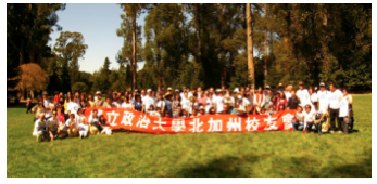
 索諾瑪(Sonoma) 巴士團一日遊 9/13/2014
加州的九月舒爽怡人,是秋季出遊的好時節。政大校友會特於九月十三日(星期六) 舉辦索諾瑪巴士一日遊,帶您走一趟人文知性之旅。
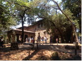
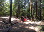
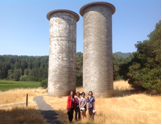
(1)傑克倫敦州立公園 (Jack London State Park)
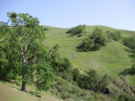
我們將造訪傑克倫敦州立公園(Jack London State Historic Park), 瀏覽滿山遍野的 葡萄藤, 享受清新的紅木森林浴, 特別參觀名作家傑克.倫敦先生紀念館及其舊居, 傑克自幼貧困,全靠勤奮自修寫作,他1903年他寫下了美國文學史上的經典之作《野性的呼喚》被譽為「世界上讀得最多的美國小說」。
![]()
![]()
![]()
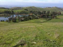
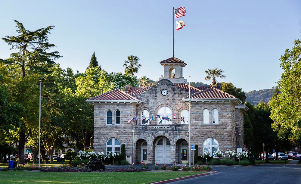
![]() (2)索諾瑪市中心(Downtown of Sonoma) 接下來我們將到索諾瑪市中心(Downtown of Sonoma), 市中心有公園廣場和百年建築可以逛逛, 校友們可自帶食物在公園野餐,或在當地自費用餐。(預計停留70分鐘)
(2)索諾瑪市中心(Downtown of Sonoma) 接下來我們將到索諾瑪市中心(Downtown of Sonoma), 市中心有公園廣場和百年建築可以逛逛, 校友們可自帶食物在公園野餐,或在當地自費用餐。(預計停留70分鐘)![]()
![]()
![]()
![]()
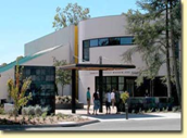
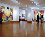
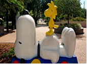
![]() (3) 休斯博物館(Charles M. Schulz Museum)
(3) 休斯博物館(Charles M. Schulz Museum)
我們將拜訪-休斯博物館, 它是紀念已故漫畫家休斯先生(Charles Schulz), 他的史努比漫畫作品 受到全世界的歡迎,曾被翻譯成25種文字, 刊登在2600種報刊 雜誌上。
活動日期: 9月13日 (週六)
報名日期:8月14日 – 9月8日
活動費用: (費用含巴士/小費,公園門票, 博物館導覽)
$40/成人, $37/學生(4-18 yrs), 幼兒三歲以下, 不佔車位者免費
截止日期:9月8日 (此日後,恕不退款,請找後補或替代)
報名辦法:
- 報名時請告知: 姓名, 聯絡電話, 畢業年次, 以及選擇上車地點. 報名後 座位可以保留 7天,於9月3日以後報名者座位只保留 2天。請儘快付費, 先付費者 才能保留座位。若報名人數額滿,會將您名字列在後補名單中。我們有三處上車地點可選擇:
- Fremont 小台北廣場 – 46807 Warm Springs Blvd., Fremont, CA 94539
- Cupertino前世界文化廣場 (Saratoga Plaza Shopping Center) 1600 S. De Anza Blvd, San Jose, CA 95129
- Millbrae Bart Station, (Millbrae Intermodal station Drop-off, Bart parking lot next to California Dr,) – 200 Rollins Road, Millbrae, CA
*** 每個上車地點人數若不足4人時,該上車地點將被取消
- 校友可用電郵,或者電話方式報名-
- 電郵: 標題(Subject) 請註明:NCUAA Trip, caroline_heng@yahoo.com
- 電話: (408) 366-0678 衡孝英 (Caroline Heng), (408) 533-5280 張惠梅 (Hui-Mei Chang)
- 所有參加活動者需簽校友會Waiver Agreement,活動組會於當日發給大家, 請簽名後於上車前交給活動組。
- 活動注意事項:
- 校友們午餐自理,活動組不提供午餐
- 請自備飲用水, 防曬油, 帽子, 請穿便鞋或球鞋易於走路,若易暈車請自備暈車藥。休斯博物館及傑克倫敦公園都有飲水機(drinking fountain)可供飲用或加水
- 預計行程及時間表:
7:20- 7:25 : Millbrae Bart Station, (Millbrae Intermodal station Drop-off, Bart parking lot next to California Dr,) – 200 Rollins Road, Millbrae, CA
8:00- 8:05: Cupertino/Saratoga 前世界文化廣場巴士登車
Saratoga Plaza Shopping Center – 1600 S. De Anza Blvd, San Jose, CA 95129
8:35- 8:40 : Fremont 小台北廣場巴士登車 – 46807 Warm Springs Blvd., Fremont, CA 94539
8:40 – 10:40: Drive to Sonoma
10:45- 12:00: Charles Schulz Museum (guided tour 45 min)
12:05- 12:40pm: Drive
12:40 – 13:50: Lunch at Downtown of Sonoma
13:55- 14:25: Drive
14:25-16:25: Jack London State Park
16:30- 17:35: Drive to Fremont (小台北廣場巴士登車處)
17:35- 18:05: Drive to Cupertino (前世界文化廣場巴士登車處)
18:05-18:45 Drive to Millbrae Bart Station, (Parking Lot 巴士登車處)